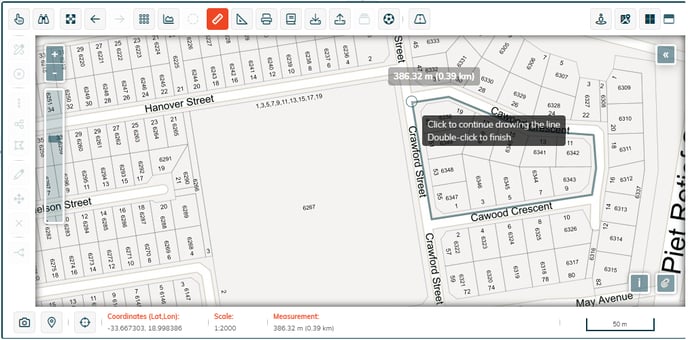
How to measure your stand?
The toolbars above the map panel have two useful features to help you measure your stand.
 Measure by line
Click on this button and then on the map to place down the first point that you want to measure from. Click again to place intermediate measurement points.
To end the line being measured, double click on the map at the desired end point.
Each line segment’s distance is added and the total distance is displayed at the end of the line.
 Measure by area
Use this button to measure the extent of an area.
Once the button is selected, click on the map to place down the first point that you want to measure from and click to place intermediate measurement points.
To close off the area being measured, double-click on the last point in the polygon that you want to measure.
The total area is displayed in the center of the polygon.

![logo-whte-1.png]](https://help.1map.co.za/hs-fs/hubfs/logo-whte-1.png?height=50&name=logo-whte-1.png)